
People don’t often associate landlocked North Texas with coastal river deltas, but our numerous artificial lakes, or reservoirs, are full of surprises! Each reservoir simulates a river entering the ocean where the dammed waterway enters deeper lake waters, creating a formation of silt known as a reservoir delta. These collections of seemingly natural wetlands and bottomland forests are ecologically similar to the native ecosystems that reservoirs flood and destroy but their landforms create something unique because they are sculpted by the same forces as coastal deltas.
White Rock Lake, one of the oldest reservoirs in Dallas, has an intriguing history of a push and pull between natural processes and human intervention influencing the shape of its delta. The graphics below illustrate these dynamics.
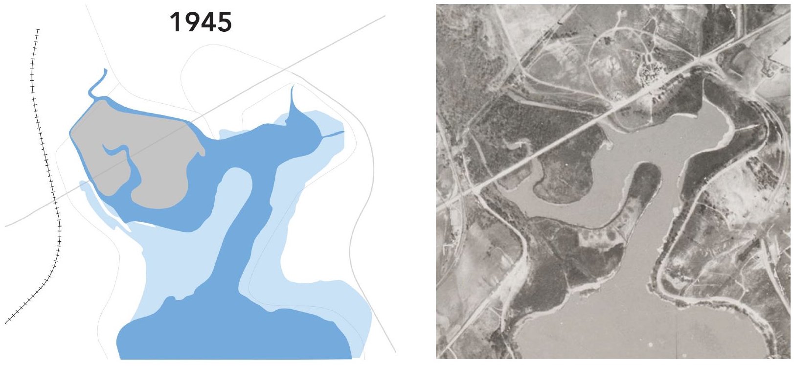
The White Rock Delta emerged as a result of the dynamic interplay between natural forces and human interventions.
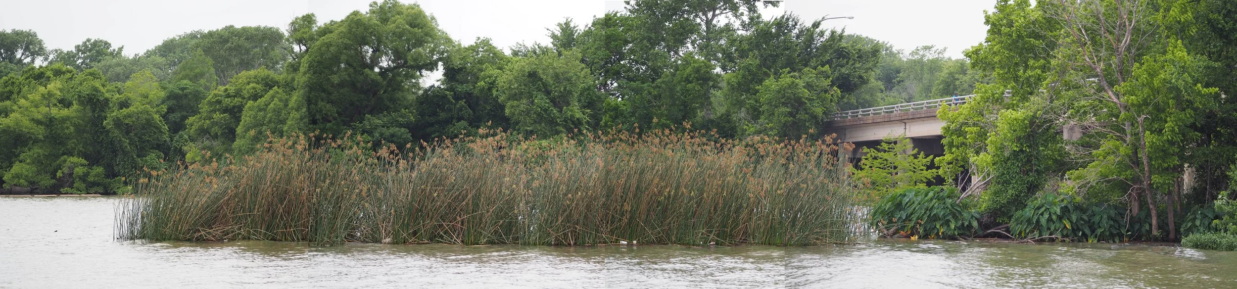
The forest in the picture above used to be open water, fully a part of White Rock Lake. Now, it’s filled with silt that the lake’s dam stops from reaching its natural destination in the Gulf of Mexico. The resulting “White Rock Delta” acts much like a coastal river delta would if the silt were allowed to be carried downstream. A century of repeated dredging and natural processes have worked together to form a unique collection of waterways, islands, and peninsulas, creating a landscape that blurs the boundaries between the natural and the artificial.

White Rock Lake: A reservoir’s birth and nature’s resurgence
White Rock Lake was built through the construction of a dam along White Rock Creek in 1910 in order to provide drinking water to Dallas. The rising waters submerged the native bottomland forests that existed along the creek. Since the lake’s construction in 1910, the delta started forming, creating islands of silt as early as 1927. By the 1930’s, it became a swampy plain, beginning the slow process of recreating the bottomland ecology that was destroyed by the lake.
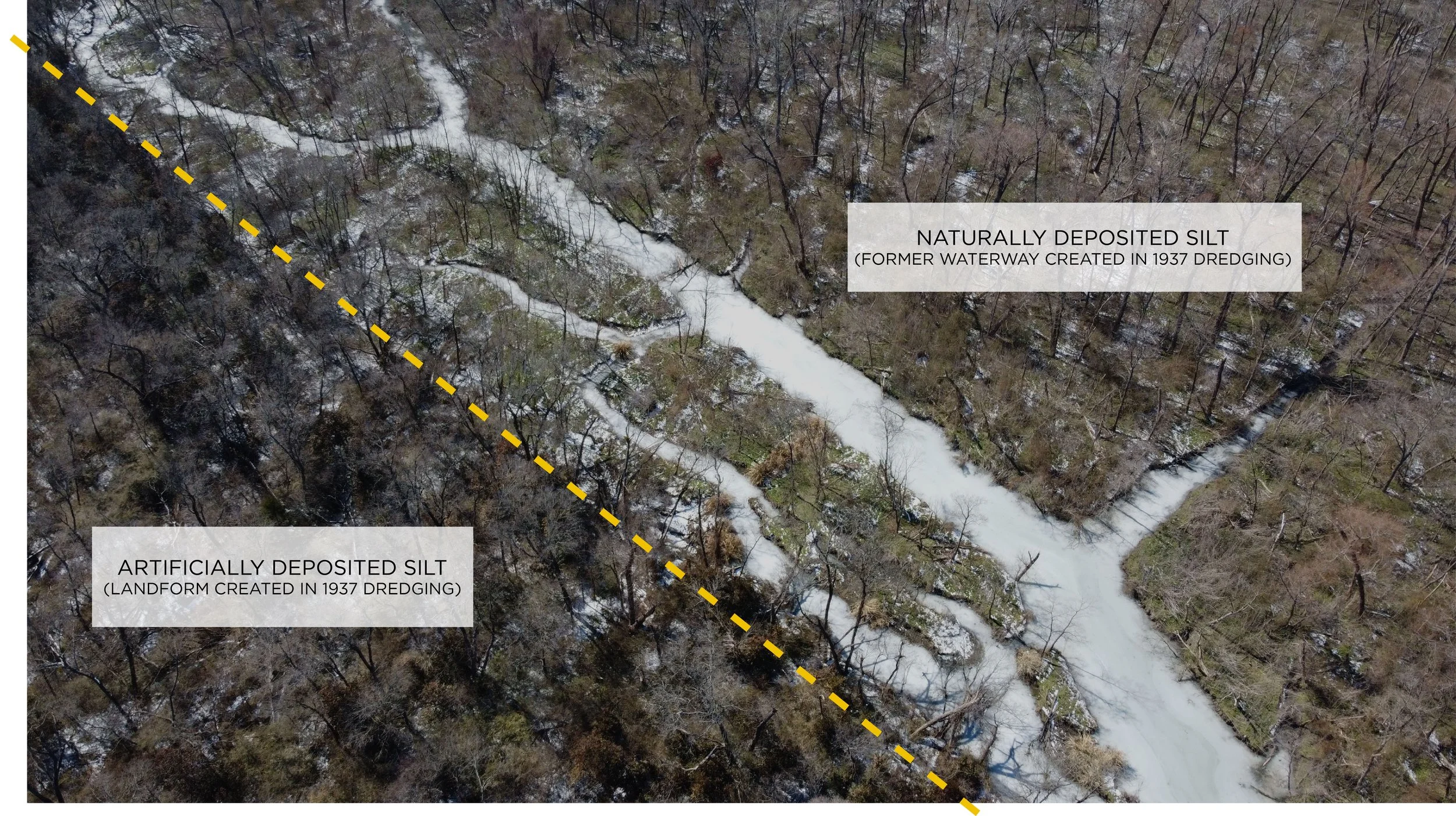
Dredging reshaped White Rock Lake, sculpting islands and water channels for future sedimentation.
As the lake filled with sediment and the delta grew, city leaders saw a need for dredging. During the lake’s first dredging from 1937- 1941, the excess sediment was poured into the delta to create more ‘clean’ and clearly defined water channels and an island. The landforms created in this dredging set the course for future sedimentation in the delta. Today, they are made visible by their dense woody understory that is distinct from the lower lying, more open areas that naturally filled in with silt in the following decades.

Sedimentation significantly expanded the delta’s land area.
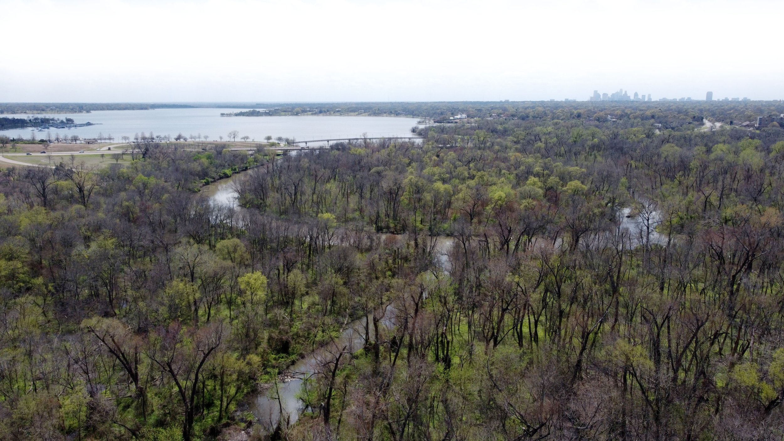
Today, the Delta is almost completely covered in emerging forests. A series of low-lying islands formed from natural sedimentation between the artificial island and peninsula created in 1937. The water channels appear to have stopped or slowed narrowing due to sedimentation, which has stabilized the amount of land area in the delta. A new peninsula made from dredged silt in the 1970s created the land where a popular dog park is today.
Natural and human-induced sedimentation contributed to the formation of islands within the delta.

The White Rock Delta is far from the only reservoir delta in North Texas. Since DFW depends on reservoirs for drinking water, over 12 were built in the 20th century to meet the demands of a growing population. White Rock Lake itself has two other large deltas where tributaries enter that create marshy areas popular among ducks as well as their human onlookers. Lewisville Lake, which is much larger, contains around 14 deltas.
Reservoir deltas evidently serve as ecological and recreational hotspots, but this is largely unrecognized. Given their notable presence in the region, we should take ownership of our surprising inland river deltas and consider their role in maintaining the health of the Trinity River Watershed and by extension, the health of DFW’s 7.6 million people.