Every large river is born from humble beginnings: a small trickle of water—often a seep, spring, or wetland area—carving a modest tributary that grows as it collects surface runoff and groundwater on its way to a larger stream. Known as headwater streams, most of these minor waterways are now buried underground, channelized, and piped out of urban areas through sewer systems, taking with them the ecological and cultural services they historically provided to communities. Although we have lost the physical and visual connection to many of these streams, flood mitigation is still serviced by these underground canals, as surface runoff is collected and funneled out of the nonporous urban landscape through the subterrain.
The saying “we all live downstream” rings as true as ever, and how we relate to our local water systems directly affects our community and every other community that lives downriver. One must first look down to understand a person’s role in the watershed. Does water flow underfoot? Where does it flow from and to?
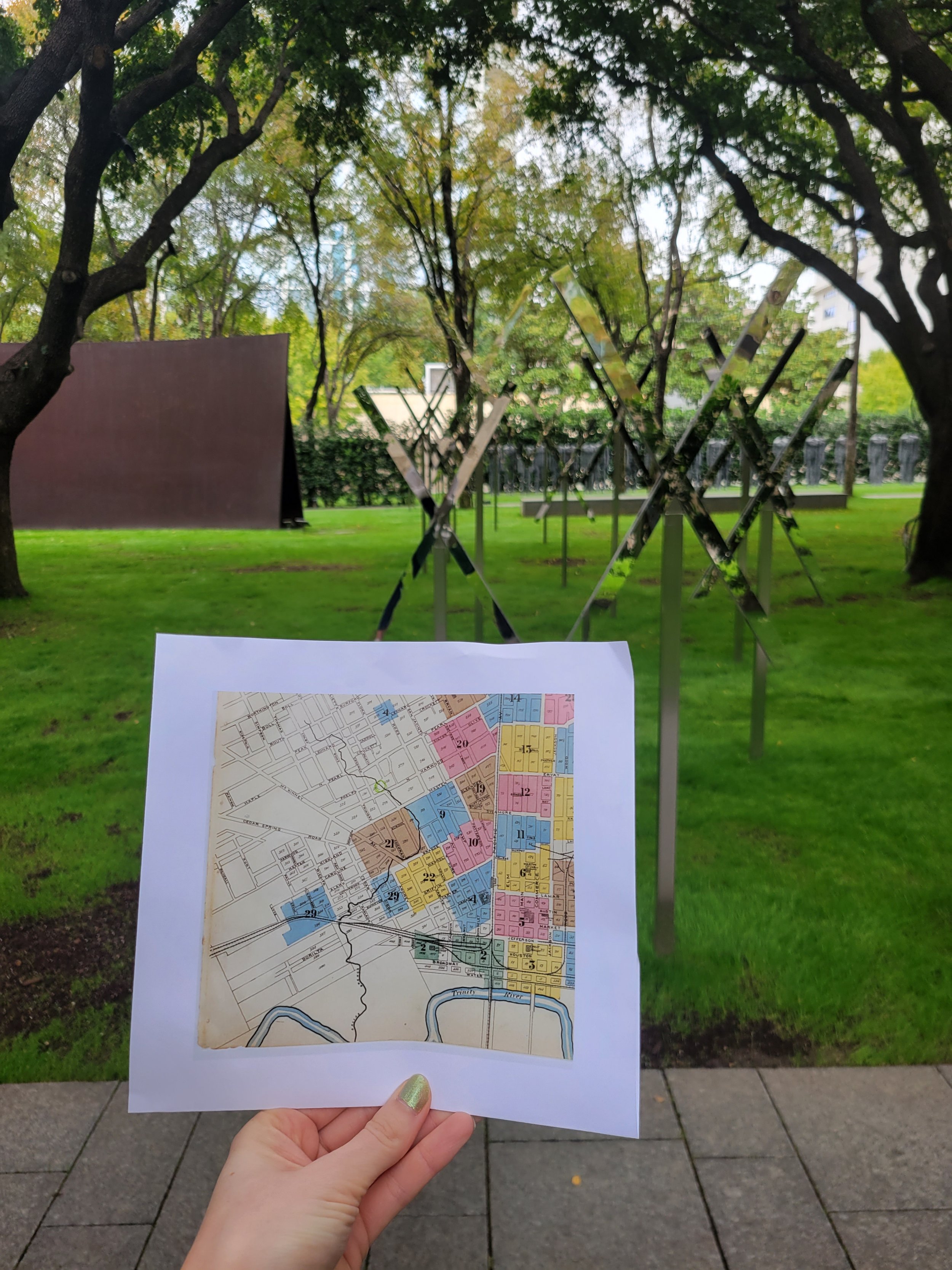
Mary Miss, an environmental artist, explored these questions through her piece, “Stream Trace: Dallas Branch Crossing,” which is currently on display at the Nasher Sculpture Center as a part of Groundswell: Women of Land Art through January 7, 2024. The exposition highlights and maps the location of a channelized stream that originates in Uptown Dallas and flows to the Trinity River.
“Stream Trace: Dallas Branch Crossing” (2023) by Mary Miss; currently on display at the Nasher Sculpture Center.
Considering Mary Miss’s sculpture, in light of Deep Ellum’s 150th-year celebration, prompted the question: Does a stream also flow under Deep Ellum?
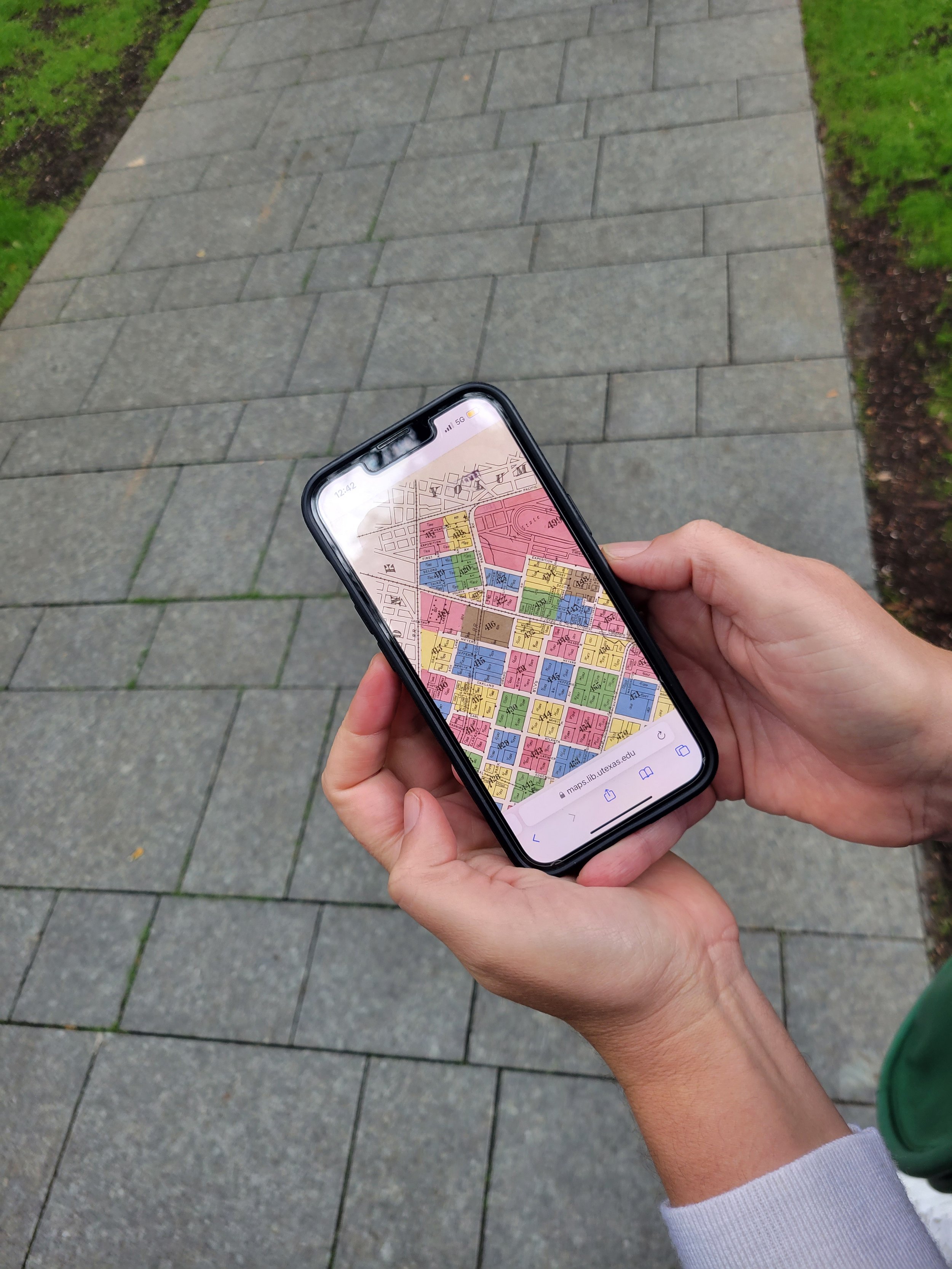
The search for answers began similarly to Mary Miss’s stream research: sifting through historic Sanborn Fire Insurance Maps. Back in 2014, Studio Outside shared a post about discovering the history of our building through Sanborn maps (Historical Maps are Cool: Did Our Office Used to Be a Veterinary Hospital?). We peeled back layers of the urban fabric using that same technique.


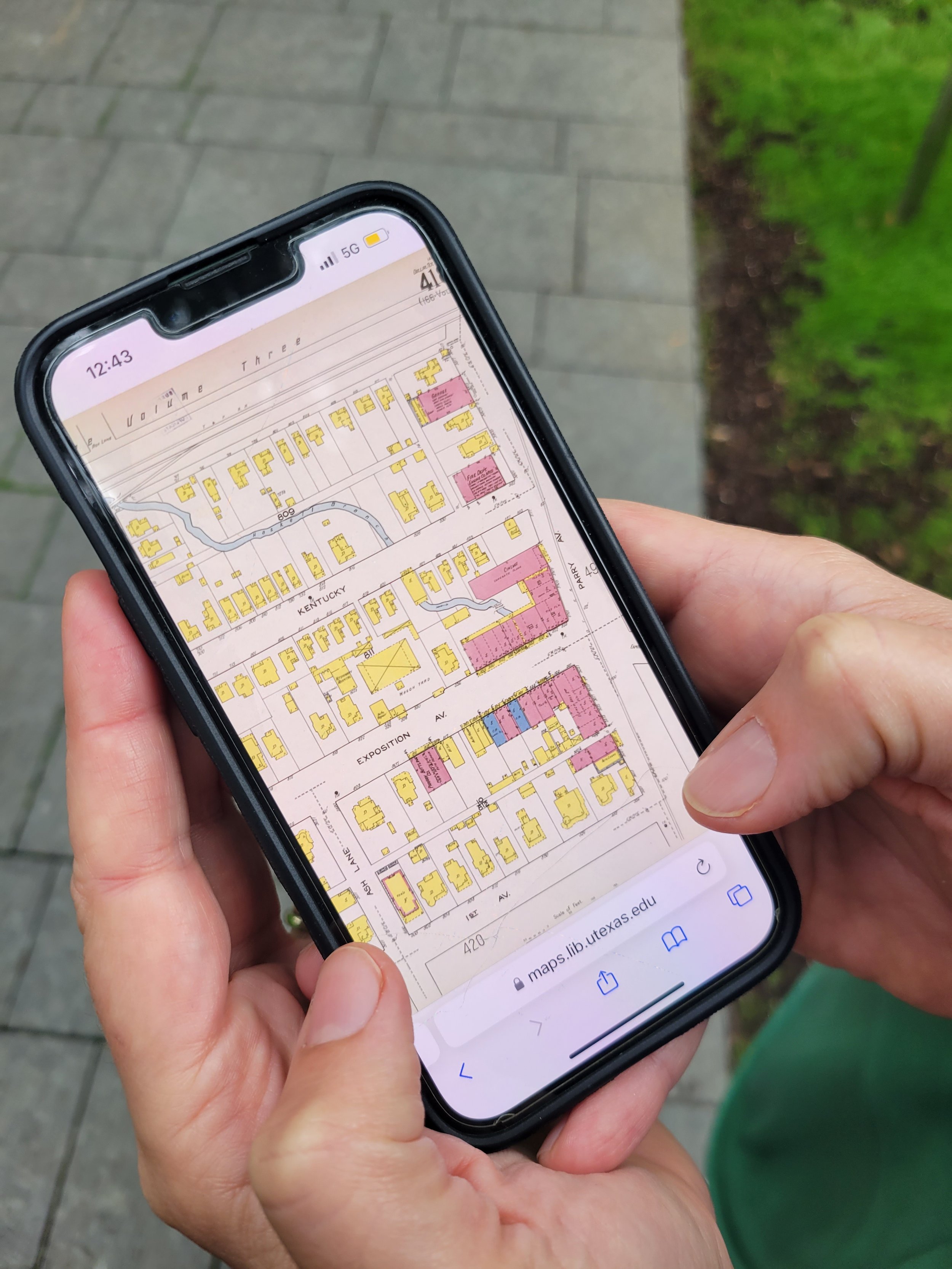
Through the pages of history, a small creek surfaced! Initially it was just a tiny line on a map without a name; however, as the years passed and newer maps depicted Dallas’s growth and development, the neighborhood expanded around the waterway over the decades. The creek was eventually given a name: Haskell Branch.
Piecing together the Sanborn maps (1921), Haskell Branch's historic path was brought to light.
We pieced together Haskell Branch’s historic path from the Sanborn maps and revealed its influence on the surrounding development. In 1921, Haskell Branch is depicted to originate under Gaston Avenue, just down the street from Lucky’s Hot Chicken, and then flows south and east, feeding into White Rock Creek and eventually the Trinity River through the Great Trinity Forest. Winding through Expo Park, the map portrays the construction of the original cinema building adjacent to Studio Outside, designed to encompass the creek (a notch in the southwest corner of the architecture to bypass the creek still exists). There was once a pedestrian bridge above a water crossing at Exposition Avenue. An exploration on foot revealed additional traces of this now subsurface stream, including an assortment of sewer grates and storm drains along its historic path.
A sewer grate in the parking lot outside Studio Outside's offices marks a point along the former path of Haskell Branch.
As Haskell Branch's former path was explored, grates and curb cuts were discovered, allowing present-day urban runoff access to this buried stream.
Another runoff access point was discovered where Haskell Branch once flowed; the Sanborn maps note that a wooden trussell crossed Haskell Branch along the tracks in the background of this image, providing passage for trains over the historic waterway.
Haskell Branch now daylights into a cement channel in South Dallas, near Jamaica Street and South Second Avenue (photo credit for figures: Google Maps).
Many conservationists call for daylighting streams to revive ecosystems in urban areas. An artist in Baltimore resurrects buried waterways through a public art installation, Ghost Rivers, which features “buried streams that still haunt the urban landscape and its residents by contributing to downstream water pollution and flooding.” For Haskell Branch at Expo Park, we are just beginning to unravel the path it winds to discover the water that flows beneath our feet.
Digital rendering depicting the hypothetical flowline of Haskell Branch’s historic path through Expo Park.


